Quezon City, Philippines
mails@fdsc.asia
Call us: (632) 913-7148


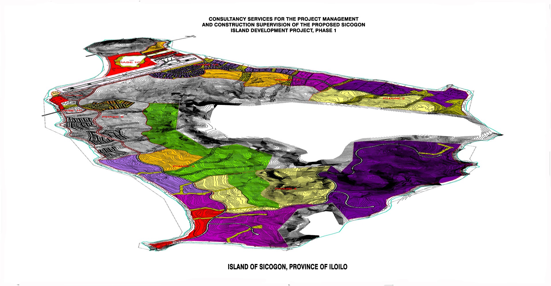
 Master Planning & Land Development
Large scale development often raises a great many planning and other issues: for example, access by different forms of transport...
 Feasibility
An impartial view and research is often helpful before carrying out a sizeable project, FDSC can work with you on this, providing an experienced outside view...
 Detailed - TEST Architectural & Engineering Design
FDSC offers a full-range of services related to detailed architectural and engineering design of vertical (buildings) and horizontal...
 Construction Management & Supervision
FDSC applies modern management techniques to the construction process in order to control both time and cost within the budgetary and...
 Environmental Engineering
FDSC seeks to be at the forefront of developing technology. It maintains a thorough understanding of the changing environmental legislation...

FDSC is now a full-service consultancy firm providing comprehensive services in engineering and specialized allied fields.
Aside from the highly specialized field of survey engineering, FDSC has now broadened its scope of service to meet the exacting demands of both local and international consulting markets. The extensive experience of its officers, consultant’s pool and key staff testifies to its capability to successfully perform the following services: Master Planning and Land Development; Feasibility Studies; Detailed Architectural and Engineering Design; Construction Management and Construction Supervision; and Environmental Engineering.
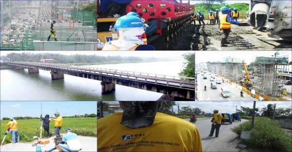
Aside from the highly specialized field of survey engineering, FDSC has now broadened its scope of service to meet the exacting demands of both local and international consulting markets.

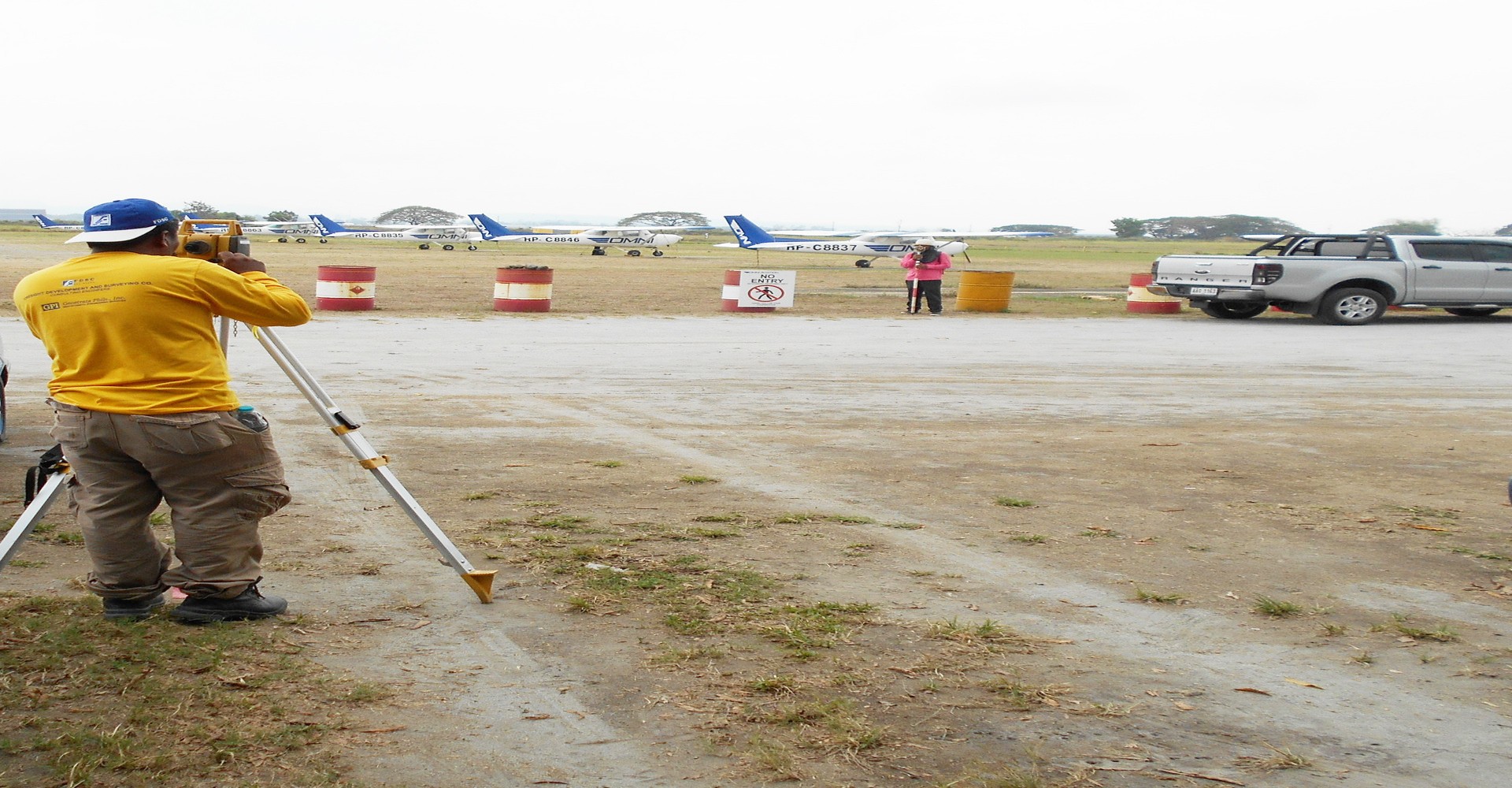
FDSC provides topographic surveying indicating the grade, slope, and terrain features of the project for land planning, engineering, and design our methods to prepare topographic surveys, including grid topography, and GPS.
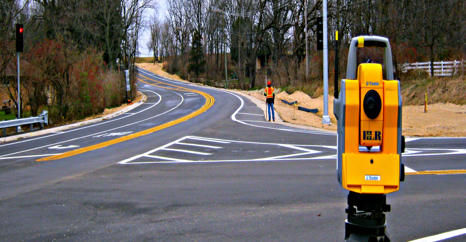
Services for road and route surveying includes locating utilities, road alignment, streams, man-made features, boundary lines, and topographical information necessary to prepare construction plans, easements, and right-of-way maps.

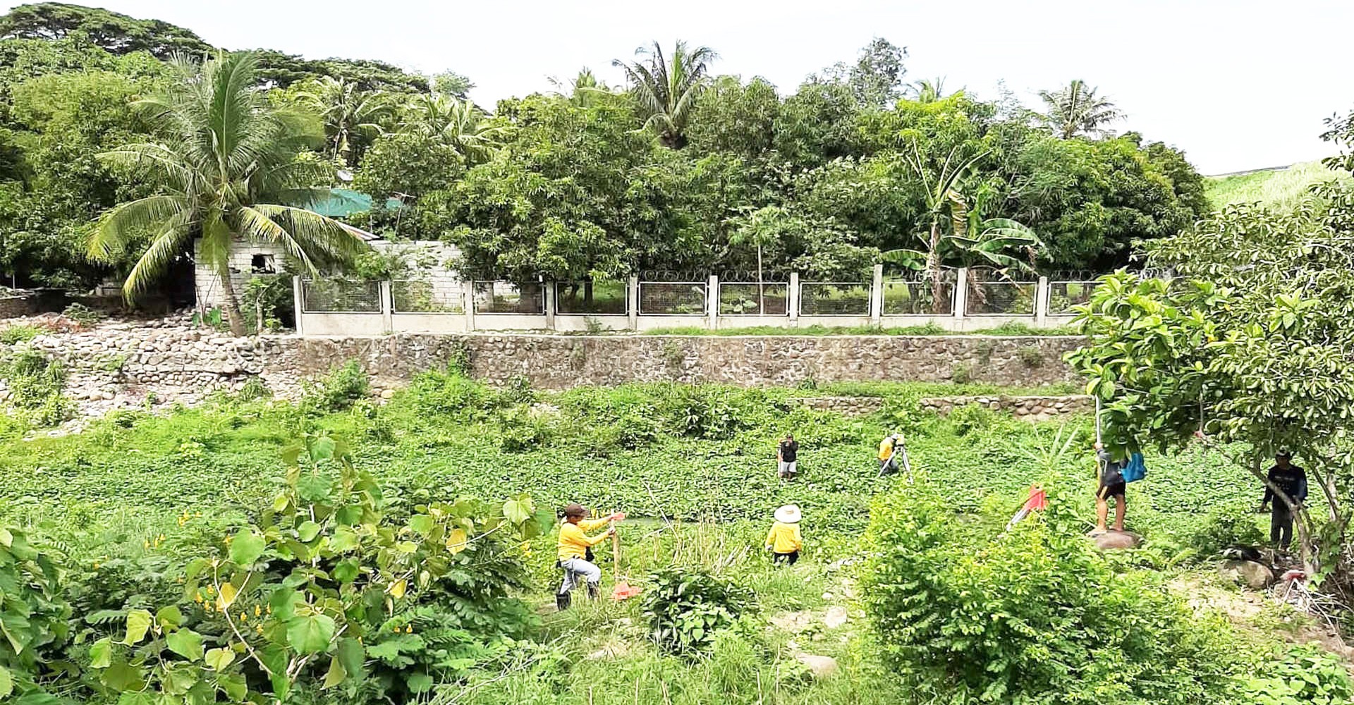
This involve mapping out of bodies of water including depth determination needed to plot the terrain of the underlying seabed, riverbed, lakebed or ocean bed.
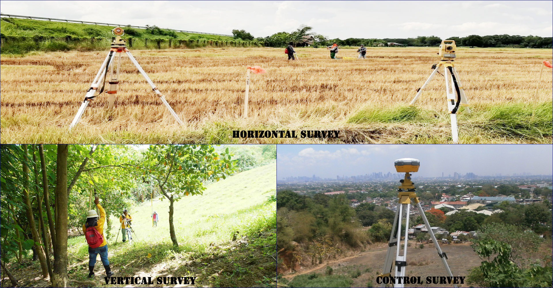
FDSC’s control surveys provide "basic control" or horizontal and vertical positions of points to which supplementary surveys and vast topographic surveys are adjusted.
FDSC provides Parcellary survey services in the establishment of official lot boundaries of tracts of land not covered by government cad recorded and filed with the Bureau of Lands.
Surveys conducted for subdividing tracts of land for purposes of sharing among heirs, segregating portions or for commercial, industrial, leisure or housing development projects.
FDSC provides relocation surveys for tracts of land with missing corners, or reported discrepancies in their boundaries. Relocation surveys enable the re-establishment of boundaries for re-marking with concrete monuments.

Lorem ipsum dolor sit amet, consectetur adipiscing elit, sed do eiusmod tempor i...
View story
Lorem ipsum dolor sit amet, consectetur adipiscing elit, sed do eiusmod tempor i...
View story
Lorem ipsum dolor sit amet, consectetur adipiscing elit, sed do eiusmod tempor i...
View story
All information, pictures and images on this site are copyrighted material and owned by their respective creators or owners.
Copyright © 2019 | Foresight Development and Surveying Company • Engineering and Surveying Consultancy
Powered by WebFocus Solutions, Inc.
Privacy & Cookie Policy
We use cookies to personalize content and ads, to provide social media features and to analyze our traffic. You consent to our cookies if you continue to use our website. Read more